


The researchers of the oceanographic campaign framed in the LIFE IP INTEMARES project have collected samples and data that will improve the scientific knowledge of the Menorca Channel.
The team of researchers from the Spanish Institute of Oceanography, which has explored the Menorca Channel within the framework of the LIFE IP INTEMARES project, has collected samples, data and images of the seabed, its flora and fauna, which will improve scientific knowledge of the area and evaluate the effects of fishing in this protected marine area.
The scientists have obtained information from areas subjected to different levels of fishing effort, both from the trawl fleet and from the artisanal fleet that uses trammel nets to catch red lobster, one of the main fishing activities in the Menorca Channel.
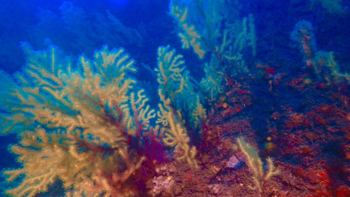
Over three weeks, more than 1,300 km have been covered with high-resolution echo sounders and 42 hours of video recordings of the seabed, its habitats and species have been made. Samples of their biological communities have also been taken, which has made it possible to preliminarily inventory a total of 360 species of algae, sponges, crustaceans, molluscs, echinoderms, sea squirts and fish, among other groups. The researchers hope to be able to improve this inventory with the 350 specimen samples that have been saved for later study in the laboratory.
Likewise, images and measurements have been taken of about 1,400 rhodoliths, calcareous algae that form the maërl bottoms. This habitat, of great ecological value, is very characteristic of the Menorca Channel, together with the rocky coralligenous bottoms.
The campaign has also carried out geomorphological prospecting and the taking of 54 sediment samples with a dredge, which has made it possible to expand the surface area of the SCI Canal de Menorca by 120 km2 that was not mapped in the LIFE+ INDEMARES project, and also to increase the resolution of this mapping, in an area of 168 km2.
To study the impact of trammel on catching red lobster, one of the researchers embarked on a professional fishing boat for five days in certain areas. In these areas, images of the seabed were taken before and after fishing, to try to estimate the direct impact of this fishing activity on seabed species and communities.
In the coming months, all the information obtained in this oceanographic campaign will be analysed.
Upcoming campaigns
The sixth campaign of the LIFE IP INTEMARES will study the area of Cap Bretón, in the Cantabrian Sea. The oceanographic vessel will set sail on June 26 from the port of Santander.
The LIFE IP INTEMARES project, coordinated by the Biodiversity Foundation of the Ministry for Ecological Transition, aims to achieve effective management of the marine areas of the Natura 2000 Network, with science and the active participation of the sectors involved.
The General Directorate of Sustainability of the Coast and the Sea of the Ministry itself, the IEO, the Spanish Fisheries Confederation, SEO/BirdLife and WWF-Spain participate as partners. It has the financial contribution of the European Union’s LIFE programme, among other sources of funding.
Do you want to know more about the oceanographic campaigns of LIFE IP INTEMARES?
You can follow our twitter profile @LifeIntemares, the hashtag #INTEMARES and enter the intemares.es website, where we inform you of the latest news on the actions of the project and marine news.
