


Analysis of tools and methodologies for monitoring, restoration and evolution of seagrass meadows in the Balearic Levantine region and the Strait of Gibraltar – Alboran Sea (MARFAN)
FEDER
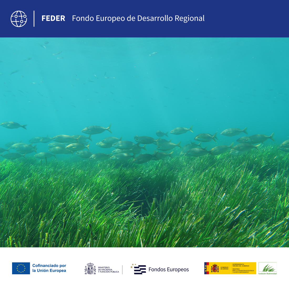
This project delves into the methodological aspects applied in marine areas of the Strait-Alboran Sea and Levantine-Balearic demarcations, in relation to the species Posidonia oceanica, Cymodocea nodosa and Zostera noltii.
Line of action:
Marine ecosystemsStatus:
En ejecuciónLocation:
Valencia and AndalusiaGeographic scope:
EspañaExecution date:
2026End date:
2028Duration:
01/02/2026 - 31/01/2028Total budget:
€422,186.49Amount of aid from the Biodiversity Foundation:
€306,532.77Aula del Mar Mediterráneo Foundation
This project will contribute significantly to the conservation of marine ecosystems in the Mediterranean by evaluating and comparing methodologies for the study of seagrass meadows. It will make it possible to identify critical areas for their protection, improve the monitoring of their ecological status and optimise restoration strategies. In addition, the valuation of associated ecosystem services will reinforce the importance of these habitats as carbon sinks, biodiversity refuges and natural erosion barriers, promoting more effective management of marine protected areas. Seagrass meadows are essential marine ecosystems for mitigating climate change, as they act as carbon sinks, storing large amounts of CO₂ in their roots and sediments for centuries. Its capacity to capture carbon is up to 15 times greater than that of tropical forests per square meter. At the same time, in large sectors of the coast they act as natural, retaining sediments and, consequently, preserving the coastline against storms. In this way, knowledge, awareness and restoration are key to its conservation.
The results will facilitate the management and conservation of these habitats, by unifying criteria, simplifying processes and improving equitable access to information. This contributes to the development of the Common Guidelines for the Management and Conservation of Marine Phanerogams, approved by the Ministry for the Ecological Transition and the Demographic Challenge.
This project seeks to identify reference mapping needs and carry out demonstration actions in areas of the Natura Network, promoting consensus on common techniques for collecting and processing data, which allow the evaluation and comparison of meadows between demarcations. It includes a pilot action to restore Posidonia oceanica.
Evaluate the different monitoring and descriptive parameters used by the different monitoring and research teams, to define the function and suitability of each one. The general objective is to agree on minimum techniques that allow comparable results to be obtained between different areas and/or monitoring equipment and, for each of the marine phanerogams: Posidonia oceanica, Cymodocea nodosa, and Zostera noltii. This evaluation includes its cartographic representation, considering the current state and the unification of categories, through common standards and protocols to provide the information to national or international viewers. The project also addresses emerging methods and technologies, such as the use of ROVs, drones, satellite imagery and tools based on artificial intelligence.


Analysis of tools and methodologies for monitoring, restoration and evolution of seagrass meadows in the Balearic Levantine region and the Strait of Gibraltar – Alboran Sea (MARFAN)
 back to search
