


GreenNet: A Tool for Multiscale Assessment of Ecological Connectivity in Estuaries (GreenNet)
FEDER
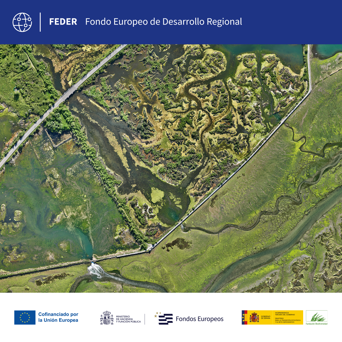
The GreenNet project develops a tool to assess ecological connectivity in estuaries using a multi-scale approach. Its actions include the creation of the GreenNet-DataHub to centralize climate and environmental information, the design of connectivity metrics in the four largest and most pressured estuaries in Cantabria, and the development of hybrid methodologies that combine numerical modeling and artificial intelligence to predict the future distribution of habitats. These methodologies are validated with multispectral sensors and integrated into the GreenNet-Dashboard, a practical, accessible and replicable tool for sustainable and resilient management of estuaries.
Line of action:
Knowledge generation and managementStatus:
En ejecuciónLocation:
Cantabria. Santander Estuary, Santoña Marshes Estuary, Oyambre Estuary, San Vicente de la Barquera Estuary.Geographic scope:
EspañaLine of research:
Development of green infrastructure, connectivity and ecological restorationExecution date:
2025Duration:
01/10/2025 - 30/09/2028Total budget:
€281,586.85Amount of aid from the Biodiversity Foundation:
€168,952.11 (60%)Coordinating entity:
University of CantabriaGreenNet represents a strategic advance in the assessment of ecological connectivity and the prediction of estuarine habitats under climate change scenarios. Its multiscale approach, which combines numerical modelling, artificial intelligence and advanced remote sensing, will make it possible to identify critical areas of fragmentation and prioritise conservation and restoration actions in the estuaries of Cantabria. The project contributes directly to the Strategic Plan for Natural Heritage and Biodiversity 2030, the National Plan for Adaptation to Climate Change and the National Green Infrastructure Strategy, generating innovative tools to efficiently manage vulnerable ecosystems and maintain essential ecosystem services.
To develop a multi-scale methodological framework to assess the connectivity status of estuaries at the regional scale by identifying the estuaries that present the greatest risk and to predict any changes in the distribution of marsh vegetation habitats at the local scale in the estuarine area. These methodologies will serve to prioritize conservation actions and improve the management of green infrastructures, strengthen the resilience of coastal ecosystems and guarantee the provision of ecosystem services.
The GreenNet project articulates its actions in five main objectives. First, review existing databases and design a data integration platform (GreenNet Data-Hub). Second, it develops a methodology to assess connectivity at the regional scale and prioritize the areas most vulnerable to fragmentation. Third, it generates and validates high-resolution probabilistic prediction methodologies for halophyte species. Fourthly, it carries out field campaigns to characterise linear infrastructures and acquire topographic and multispectral data. Finally, it designs and develops the GreenNet-Dashboard and executes actions for dissemination and transfer of results.

GreenNet: A Tool for Multiscale Assessment of Ecological Connectivity in Estuaries (GreenNet)
 back to search
