


Marine and fishery biodiversity observation network of Galicia and the Cantabrian Sea (DIVERSIMAR)
MITECO
- The project has contributed to the increase of knowledge about marine biodiversity on the Galician and Cantabrian coasts.
- The marine biodiversity catalog has collected identifying data on 142 species of fish and invertebrates.
- DIVERSIMAR aims to respond to the current need for accessible, standardized and revised information on species distribution, which will help marine users and managers to develop control plans and conservation strategies.
- The project’s citizen science program has promoted public participation, combining research with environmental education and scientific dissemination, resulting in a total of 437 species sightings.
- The initiative is aligned with the objectives of the LIFE INTEMARES project.
The ocean is one of the world’s major reservoirs of biodiversity. In Spain, the different oceanographic and biogeographical conditions and the extraordinary variety of coastal habitats (estuaries, marshes, coastal lagoons, extensive cliff coasts, beaches and island groups of very variable size) favour an enormous diversity of marine flora and fauna. In addition, the waters of the north of the Iberian Peninsula are located in a border area that constitutes a real biodiversity hotspot, where we find species typical of temperate waters that mix with more boreal or southern species. In addition, it is home to some unique species associated with the unique areas and some others that migrate from warmer areas as a consequence of global warming.
The main objective of the DIVERSIMAR project is to obtain a tool for the information and monitoring of the biodiversity of the marine area of the Cantabrian Sea and Galicia. This tool is based on an information system that compiles existing information and serves as a source of data to record the changes that are occurring in the seas, as well as allowing access and collaboration of users of the sea, using citizen science.
In addition, this web tool is intended to integrate information on the distribution, biology and ecology of a relevant number of species. Thus, according to the Spanish Institute of Oceanography, the importance of this project lies in the current need to have accessible, standardized and revised information on the distribution of species to help marine users and managers to develop control plans and conservation strategies.
The main objective of the project has been the design, development and implementation of a network for the observation of marine and fisheries biodiversity in Galicia and the Cantabrian Sea.
The specific objectives were as follows:
- To obtain a tool for the information and monitoring of marine and fisheries biodiversity in Galicia and the Cantabrian Sea.
- Establish a collaboration network with the sectors involved in the marine environment in the area and through citizen science methodologies.
- Collection and organization of available scientific data and development of biological and spatial databases. Thus, on the one hand, data on the biology and ecology of 142 species have been collected and, on the other hand, geo-referenced data on the abundance and distribution of 183 species of fish and cephalopods from scientific campaigns.
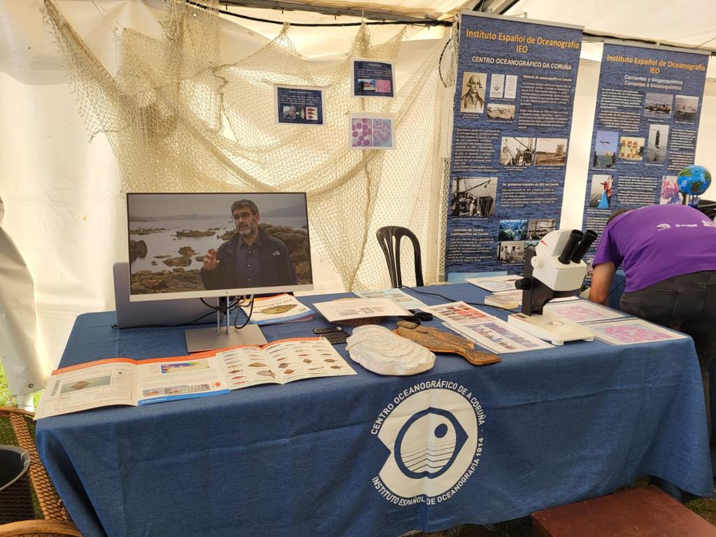
- Preparation of the Catalogue of the biodiversity of the species that inhabit the waters of Galicia and the Cantabrian Sea, in order to facilitate the identification of species of bony fish, sharks and rays, cephalopods, crustaceans and other invertebrates such as sea squirts, holothurians, gastropods or anthozoans, by any interested person. Several data sheets with scientific and photographic information were also designed for each species detected in the study area.
- Definition of a data model, implementation in an online database and development of the website that integrates the “Biodiversity Catalogue”, the web map viewer and the mobile application for data collection, as well as the information of the project and the informative resources prepared within the framework of it.
- Development of a species distribution map viewer for the period from 2010 to 2019. for the period from 2010 to 2019.
- Development of a mobile application for capturing and sending observations to be displayed on the viewer. The app is completely free and can be used by both the general public and specialized researchers, allowing them to take photographs and videos, provide comments and automatically detect the position of the observations, which can be manually modified by the user in case it is incorrect. A total of 132 volunteers participated and a total of 187 species were identified.
- Development of a collaborative network of sea users, including fishing associations, fishermen’s associations, recreational fishing, diving, surfing and sailing sports federations, environmental NGOs, scientific organizations, administrations, the educational community and private citizens. Its objective is the coordination and transfer of knowledge among the different agents to improve the sustainability of marine resources and ecosystems. This citizen science platform has included volunteer actions from the fishing sector, a whale watching program in the Bay of Biscay, face-to-face talks aimed at the educational community, collaborations in other scientific projects and programs, etc.
- Dissemination and communication of the project through the celebration of 5 conferences and workshops to present both the project and its final results to different sectors (fishermen, shellfish gatherers, fishmongers in fish markets and markets, divers, surfers, scientific schools and the general public). We also gave 5 environmental education talks in 3 primary schools and 2 secondary schools and participated in more than 10 workshops and seminars organized by other entities. On the other hand, in order to encourage citizen participation, 4 guides have been prepared to learn how to identify the marine species of common fish, flatfish, trolling fish and rays present in the fishing grounds of the Bay of Biscay and Northwest Spain. Thus, it has designed 4 brochures and 2 posters for species identification, which have been distributed both digitally and in paper format. With regard to media dissemination, 4 press releases have been prepared, more than 40 interviews have been carried out on radio, 2 round tables have been participated, 4 informative videos have been edited about the project and more than 1,270 publications have been made on Twitter. Finally, in order to publicise activities related to citizen science among a more technical audience, the entity has published 7 articles in local and regional specialist press media dedicated to digitalisation, fishing activity, diving and sectors whose activities are related to the marine environment, and has participated in 2 scientific congresses.
DIVERSIMAR is a project of the Spanish Institute of Oceanography (IEO-CSIC) that compiles scientific information on marine and fisheries biodiversity in the north and northwest of the Iberian Peninsula and whose objective has been to establish an accessible source of scientific data and serve as a basis for studying marine species. In addition, it aims to be a collaborative network that connects science and society through the promotion of citizen science. To this end, a system was designed that integrates both the scientific information available from the IEO (on distribution, biology and ecology of marine species) and the new information generated thanks to the collaboration of users of the sea who participate in the project through a citizen science program.
On the
project web portal
you have access to the tools developed by the team, such as the “Biodiversity Catalog of Galicia and the Cantabrian Sea”, the web map viewer, the app and other informative documents. The “Biodiversity Catalogue” consists of a series of descriptive sheets to help in the identification of the species of fish and invertebrates of our coasts in an easy and visual way and that contain information on their biology, ecology and distribution, which is regularly reviewed and updated. Thanks to all the contributions, the catalog has been completed with up to 142 species.
For its part, the web map viewer is an application that allows you to view and consult georeferenced information from scientific data from IEO oceanographic campaigns dedicated to fisheries resources and marine biodiversity (the series of historical data from the IEO campaigns allows you to monitor and detect the changes that are taking place over the years). In total, the viewer has 183 georeferenced fish and cephalopod species distribution data.
In addition, the web viewer also allows you to view the contributions reported in the citizen science program of the DIVERSIMAR project, which has promoted public participation by combining research with environmental education and scientific dissemination, and its objective is to improve knowledge about biodiversity and conservation so that anyone can participate by sending their findings through the mobile application created for this purpose. In this regard, the citizen science program has yielded very positive results, as from May 2020 to December 2022 a total of 437 sightings have been received and a total of 132 volunteers have participated. Likewise, based on the information reported by users through the app, 187 species have been identified.
On the other hand, in relation to the dissemination of the project, the project has included, among other actions, the holding of 5 environmental education talks given and participation in more than 10 workshops organized by other entities, the edition of 4 visual identification guides of marine species of common fish, flatfish, trigods and rays, participation in 2 round tables and more than 40 interviews in radio media, the production of 4 informative videos, more than 50 news items and more than 1,270 tweets or the writing of 7 articles in local and regional specialist media.
Finally, the entity has fostered collaboration with other entities belonging to different sectors linked to the marine environment. Among them, it is worth highlighting the contribution of information on the distribution of non-native and invasive species in the North Atlantic Demarcation within the framework of the LIFE INTEMARES project, the collaboration with the Atlantic Islands of Galicia Maritime-Terrestrial National Park, as well as participation in the Fisheries Science Table, co-chaired by the General Secretariat of Fisheries of the Ministry of Agriculture, Fisheries and Food (MAPA) and the General Secretariat for Research of the Ministry of Science and Innovation.

Marine and fishery biodiversity observation network of Galicia and the Cantabrian Sea (DIVERSIMAR)
 back to search
